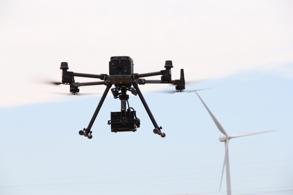
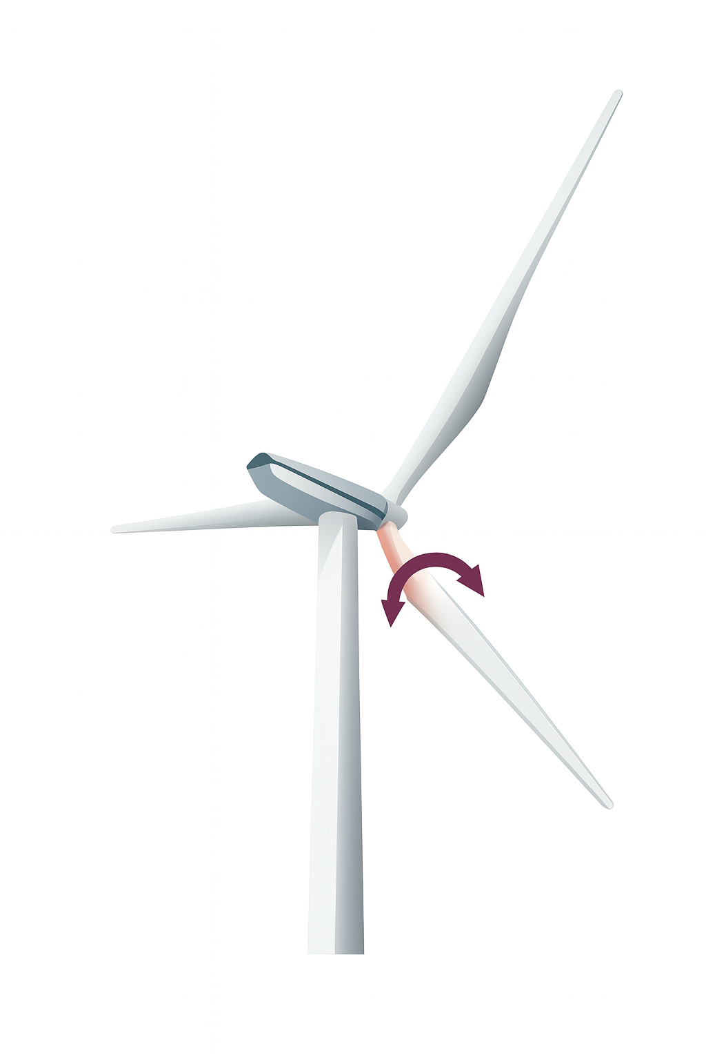
Measurement configuration with the DragonSky
The DragonSky system consists of a DJI Matrice 350 RTK drone and a high-precision LiDAR sensor.
While hovering in front of the operating wind turbine’s rotor, the drone enables the LiDAR to capture the geometry of the rotating blades.
Measurements are taken at various distances from the rotor, depending on the turbine type, to ensure optimal and tailored data acquisition.
3D reconstruction of the rotor after point cloud processing
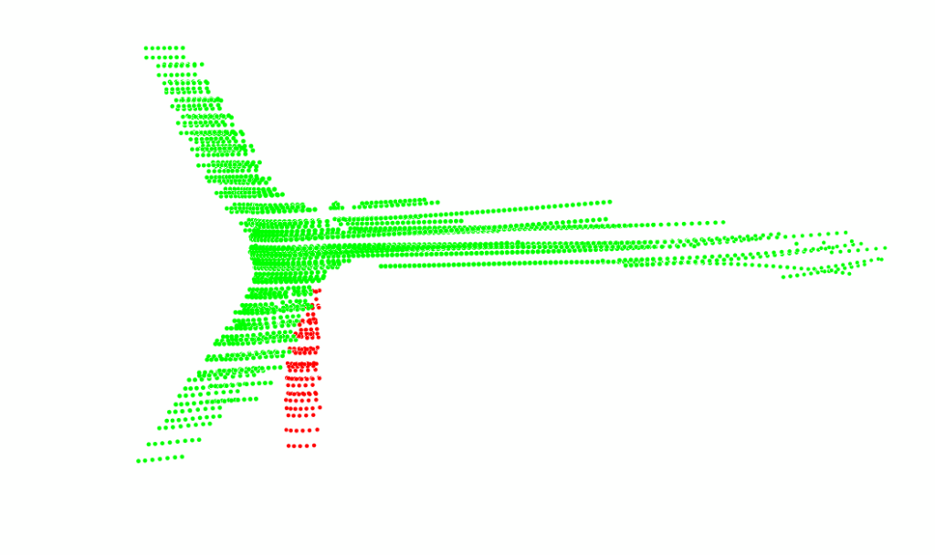
Point cloud scanned by the LiDAR
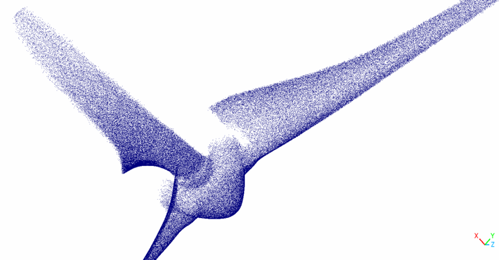
3D reconstruction of the rotor
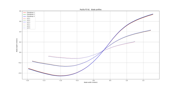
Blade profiles after calculation
Illustration of blade profiles measured by the DragonSky
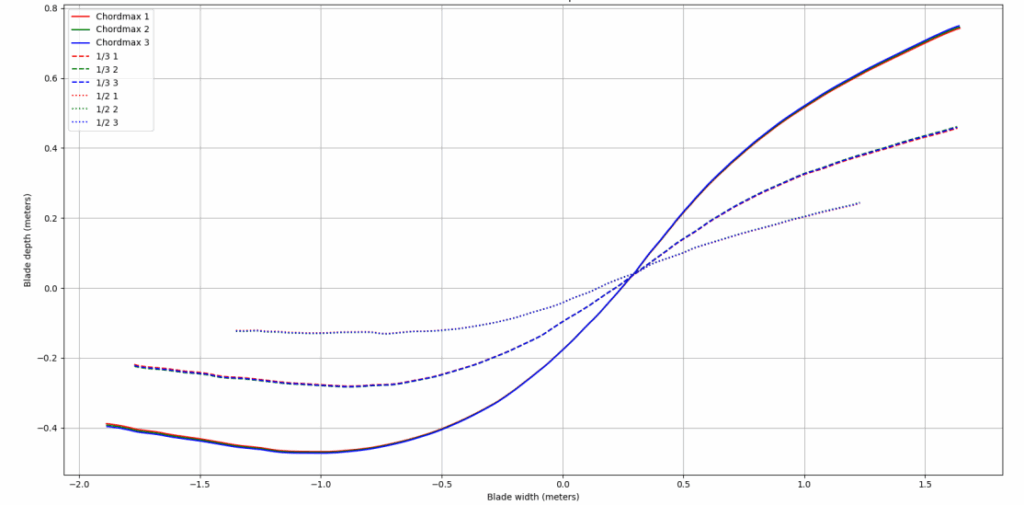
Profiles with 0.11° deviation
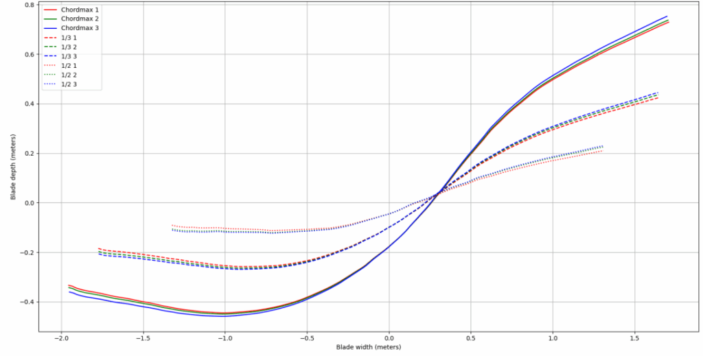
Profiles with 0.65° deviation
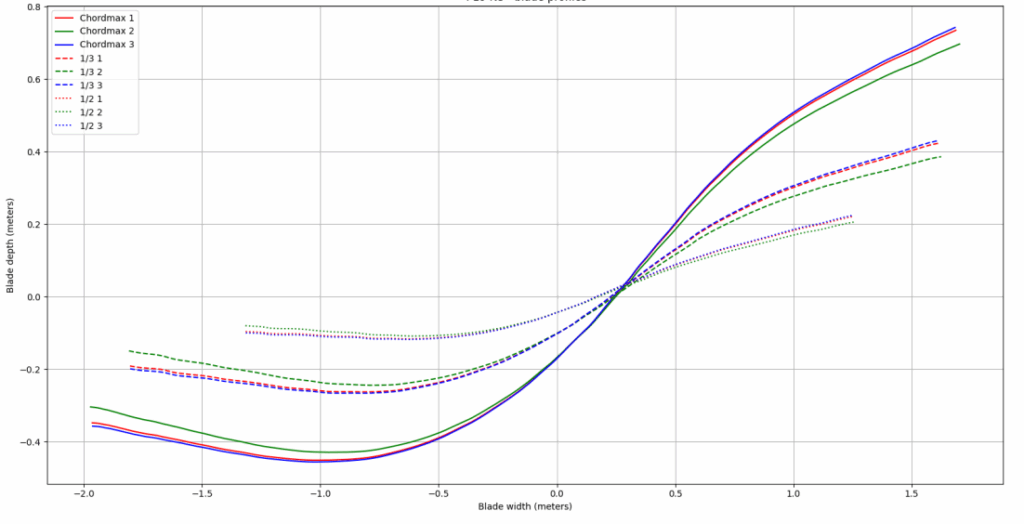
Profiles with 1.57° deviation
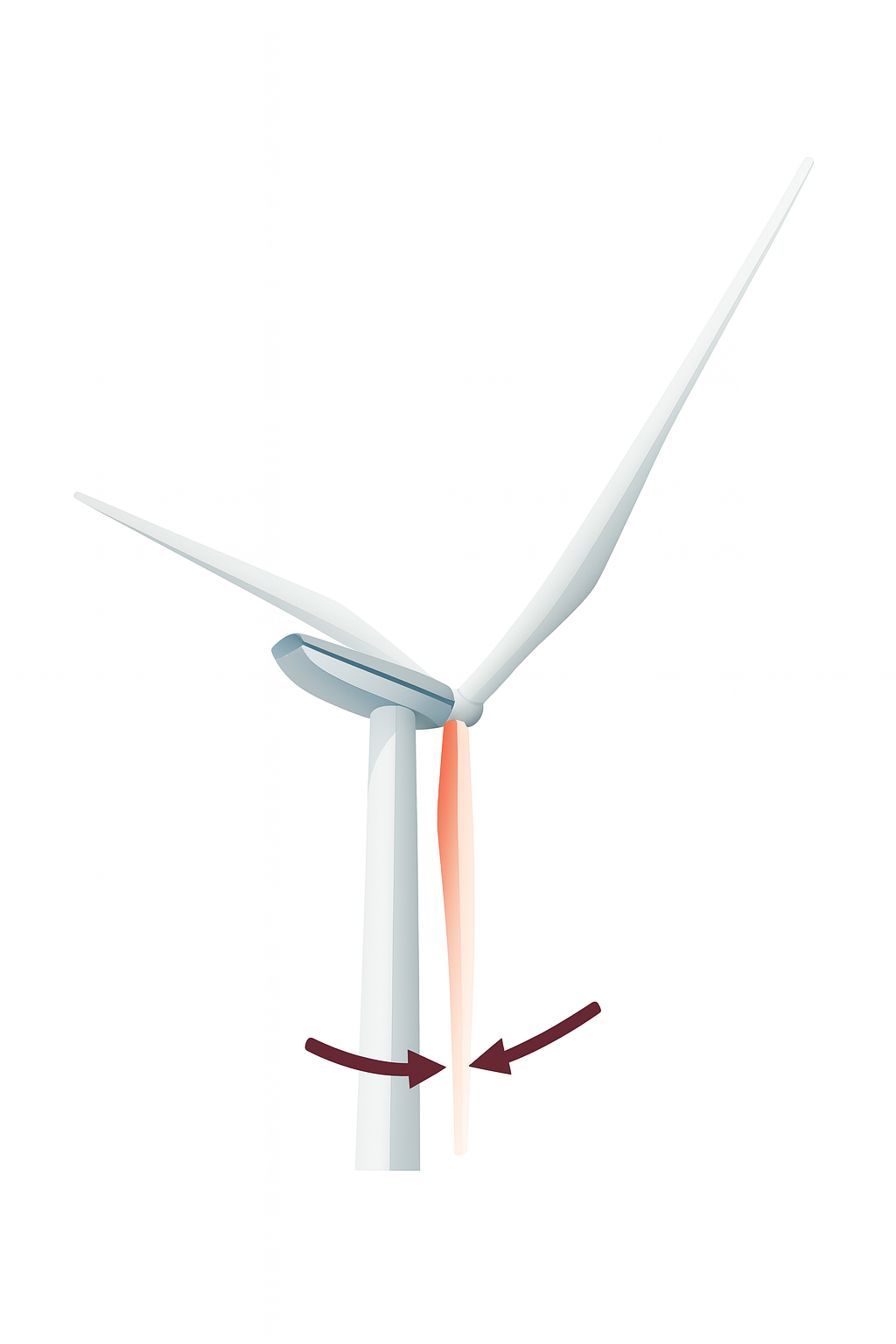
Different DragonSky control points
Relative pitch angles +/- 0.15°
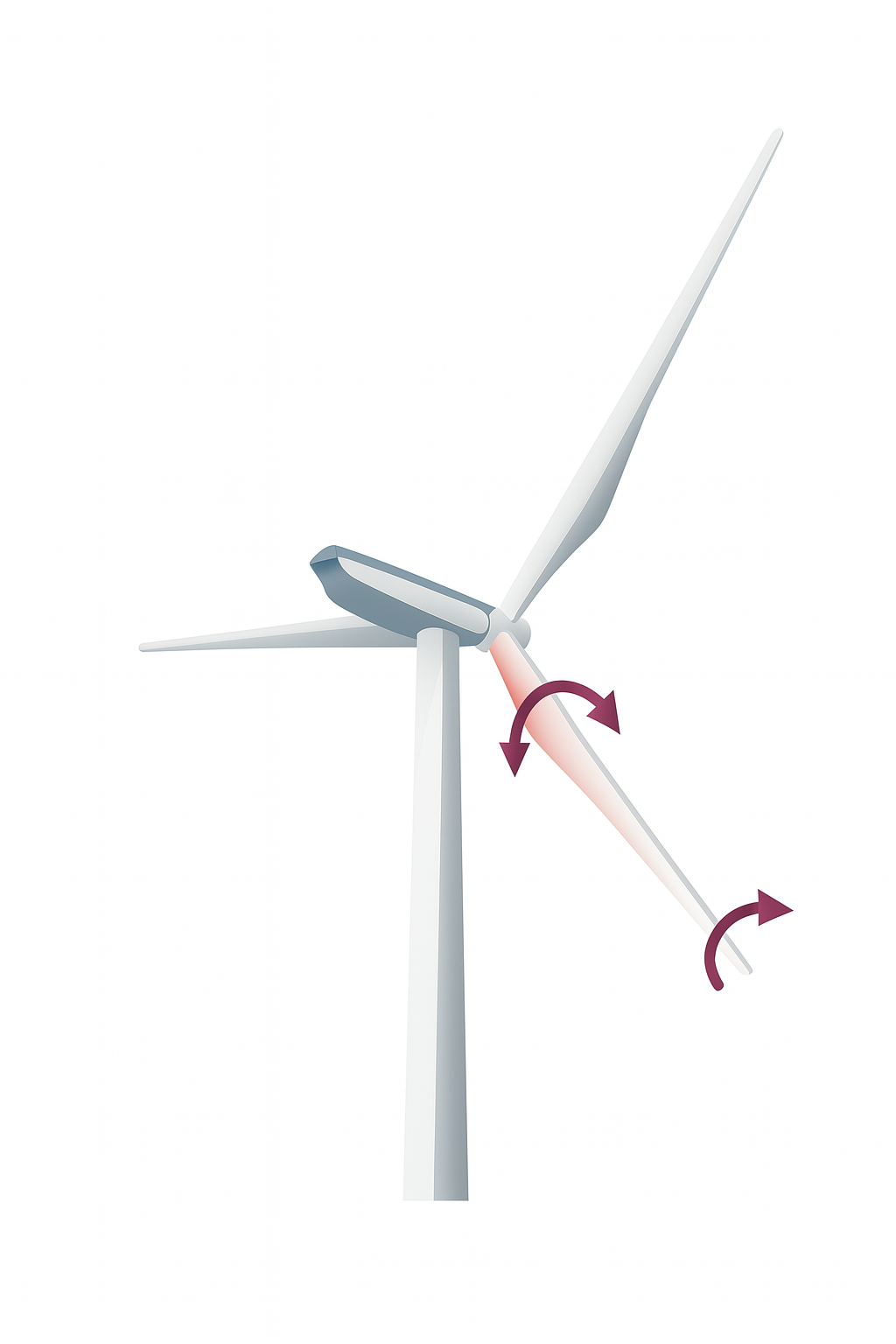
Twist angle +/- 0.3°
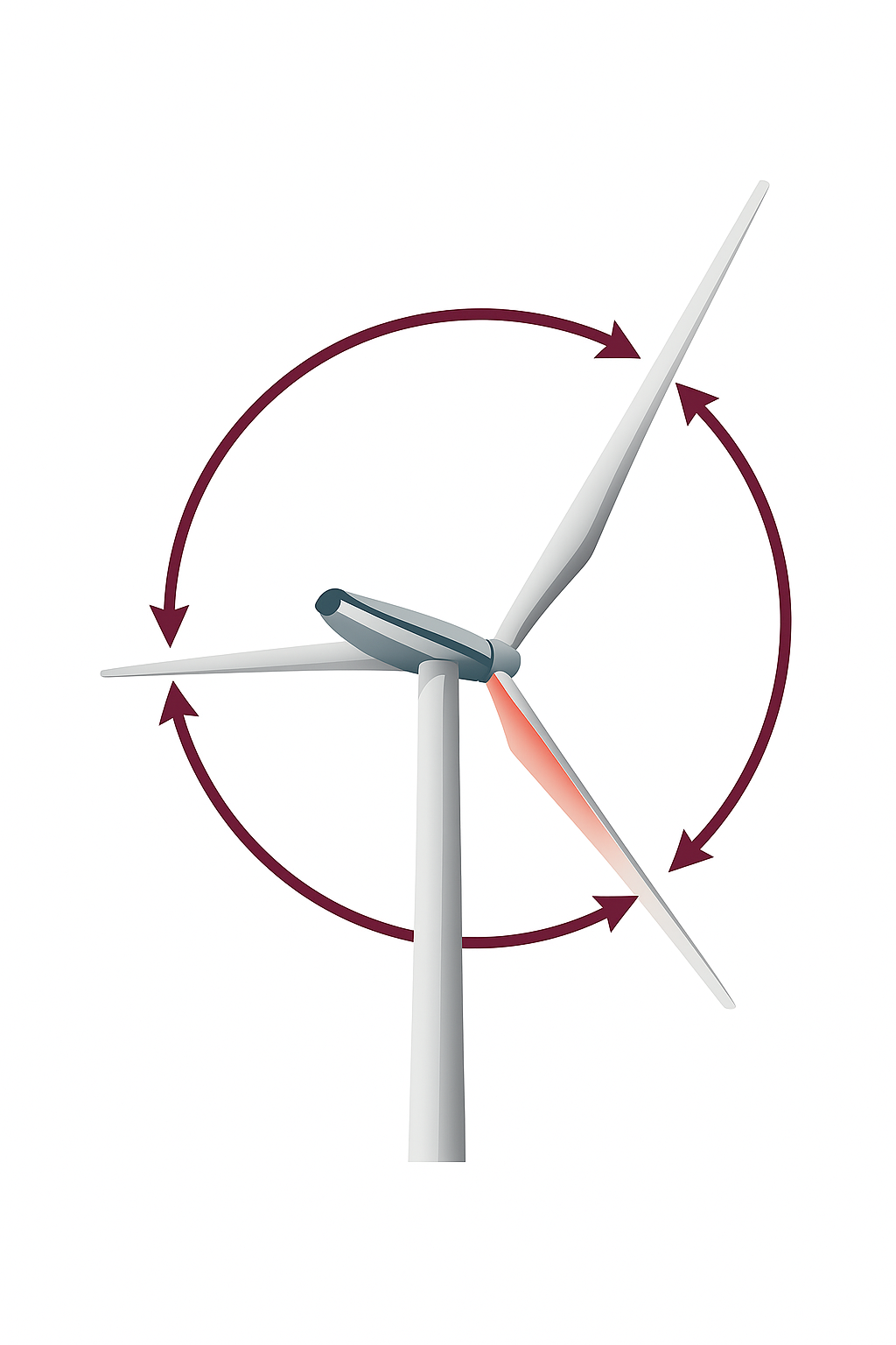
Radial splitting +/- 0.2°
Tower clearance +/- 30mm